

| Total Area (Region) | ~400,000 sq miles (Approximate combined Argentine and Chilean Patagonia) |
| Peak Travel Season | November – March (Southern Hemisphere summer) |
| Primary Argentine Gateway | El Calafate (ECA airport) |
| Primary Chilean Gateway | Punta Arenas (PUQ airport) |
| Torres del Paine W Trek Duration | 4–5 days typical (Varies by fitness and conditions) |
| Average Summer Temperature Range | 5°C – 18°C (41°F – 64°F) (Highly variable by site and elevation) |
What Patagonia Actually Is (and Isn't)
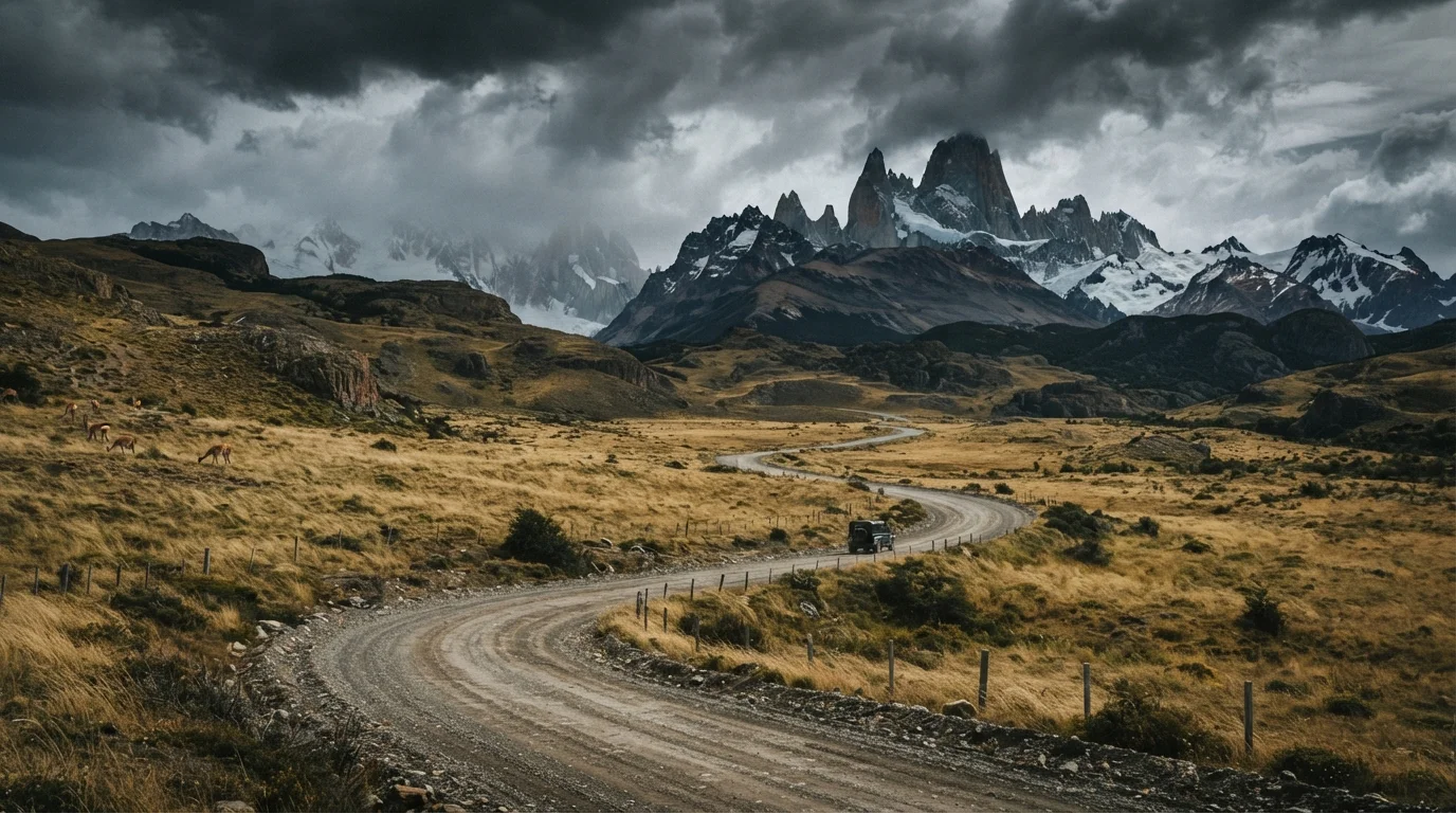
Patagonia is not a single park, a single country, or a single climate zone. It is a region spanning the southern third of both Argentina and Chile — roughly 400,000 square miles in total — covering everything from wind-scoured Andean peaks to Atlantic coastline and cold desert steppe. When travelers say they're "doing Patagonia," the itinerary could range from a week in Torres del Paine to a month-long loop crossing three international border crossings.
| Total Area (Region) | ~400,000 sq miles (Approximate combined Argentine and Chilean Patagonia) |
| Peak Travel Season | November – March (Southern Hemisphere summer) |
| Primary Argentine Gateway | El Calafate (ECA airport) |
| Primary Chilean Gateway | Punta Arenas (PUQ airport) |
| Torres del Paine W Trek Duration | 4–5 days typical (Varies by fitness and conditions) |
| Average Summer Temperature Range | 5°C – 18°C (41°F – 64°F) (Highly variable by site and elevation) |
Understanding the geography up front is the single most important step in planning a realistic trip. The Chilean side is dominated by fjords, narrow channels, and dense temperate rainforest. The Argentine side is drier, more open, and generally more accessible by road. These two landscapes require different gear, different travel rhythms, and sometimes completely different seasons.
Distances and Transit: The Numbers That Change Plans
Travelers consistently underestimate how long it takes to move between Patagonia's marquee destinations. Road distances are large; road quality adds time on top of that.
- El Calafate to El Chaltén (Argentina): Approximately 220 km by paved road — typically 3 hours each way. The drive itself is stunning, but plan it as a dedicated travel day.
- Puerto Natales to Torres del Paine entrance (Chile): About 110 km, taking 1.5 to 2 hours depending on road conditions and season.
- El Calafate to Puerto Natales (crossing the border): Roughly 340 km including the Río Turbio border crossing — allow 4 to 5 hours minimum.
- Punta Arenas to Torres del Paine: Approximately 250 km, typically 3.5 hours by road. Ferry crossings on some routes add time.
Internal flights exist between Punta Arenas, Puerto Natales (seasonal), El Calafate, and Ushuaia, but schedules are limited and disruptions common. Build buffer days around any flight that connects to an onward journey.
80+ km/h
Typical peak wind gusts in high season
Wind is a constant reality across both sides of Patagonia, even during peak summer months.
4–5 hrs
Drive time: El Calafate to Puerto Natales
Including the Argentine-Chilean border crossing, one of the most common cross-border routes in the region.
Months ahead
Typical lead time for refugio bookings
High-demand parks like Torres del Paine see refugio and camping spots fill up well before the season opens.
Weather Windows: When to Go and What to Expect
Patagonian weather is famously volatile, and no season eliminates that volatility — it only shifts the odds. The core high season runs from November through March (Southern Hemisphere summer), when days are long, temperatures are milder, and hiking trails are fully accessible. That said, wind speeds in this period regularly exceed 80 km/h, and the region can cycle through sun, sleet, and rain within a single afternoon.
Refugio
A staffed mountain hut offering dormitory beds and meals inside national parks. In Patagonia, refugios along major treks like the W Circuit require advance reservations and are a central part of multi-day hiking logistics.
Estancia
A large ranch property, common across Argentine and Chilean Patagonia, many of which offer accommodation and activities to travelers. They range from basic working farms to upscale lodges.
Pampas / Steppe
The open, windswept grassland covering much of eastern Argentine Patagonia. Drier and more exposed than the Andean side, it forms the backdrop for long road journeys between destinations.
CONAF
Chile's National Forestry Corporation, the agency that manages national parks including Torres del Paine. Entrance permits and camping regulations for Chilean parks are administered through CONAF.
Shoulder seasons — October and April — offer fewer crowds and often dramatic light, but some facilities close and trail conditions vary. Winter (May through August) brings heavy snowfall at altitude, park closures, and much shorter daylight. Only very experienced winter trekkers should plan technical routes outside the summer window.
On the Chilean side, the western aspects of Torres del Paine receive significantly more precipitation than Argentine steppe destinations at the same latitude. Packing waterproof layers is non-negotiable regardless of forecast.
Honest Expectations: What First-Time Visitors Often Miss
Patagonia rewards patience and punishes rigid itineraries. Several realities are worth stating plainly before you commit to a plan:
- Iconic viewpoints are not guaranteed. Torres del Paine's towers are famously hidden by cloud for significant stretches even in high season. Build in multiple days at key sites rather than treating them as single-day checkboxes.
- Accommodation books out months in advance. Refugios inside Torres del Paine and popular estancias along the Argentine lake district reach capacity early in the season. Booking late means either rerouting or camping.
- Self-drive adds flexibility but demands preparation. Gravel roads, unexpected closures, and sparse fuel stations are standard. Carry extra fuel, a physical map, and understand your rental insurance coverage before leaving paved roads.
- Cell service is minimal outside towns. Offline maps and downloaded itineraries are practical necessities, not optional extras.
- Currency and cash still matter. Card acceptance is inconsistent in rural Argentine Patagonia in particular. Check current currency conditions before travel — the exchange situation changes and official guidance should be verified through current sources.
Visa and Entry: Verify Before You Travel
Entry requirements, border crossing hours, and park permit rules change periodically for both Argentina and Chile. Always consult the official government websites of both countries and your national foreign affairs department before finalizing travel plans. Do not rely on travel blogs or forum posts for current border or entry information.
None of this is meant to discourage — Patagonia consistently ranks among the most rewarding long-haul destinations for travelers who arrive prepared. The gap between expectation and experience almost always comes down to underestimating distances and overestimating weather predictability. Adjust for those two variables, and the region delivers.